As climate change threatens communities and historic sites on the Arctic coast, a researcher is using maps to work with communities to identify what should be saved.
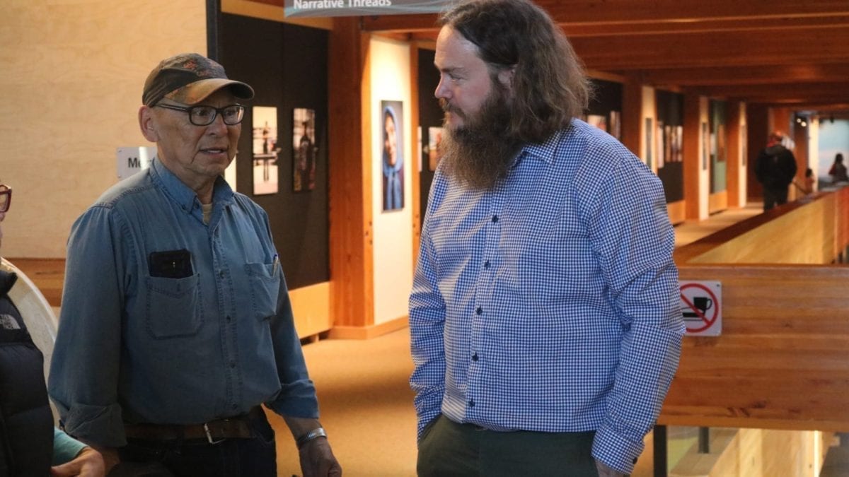
Simon Whitehouse/NNSL photo
“There are all kinds of impacts taking place,” said Michael O’Rourke, a postdoctoral fellow stationed at the Prince of Wales Northern Heritage Centre.
O’Rourke is studying the Kigmallit Bay region in particular, around the Beaufort Sea, which contains Tuktoyaktuk as well as Kuukpak, an old Inuvialuit village, among other sites.
He’s also working with territorial archaeologist Glen MacKay to look at the territory as a whole.
A main risk to Tuk and Kuukpak is coastal erosion. As storms on the Arctic Ocean increase and permafrost thaws, both attributable to climate change, Canada’s Arctic Coast is receding.
Artifacts and sites on the coast are being slowly lost, as are other significant items that have been preserved over centuries in permafrost.
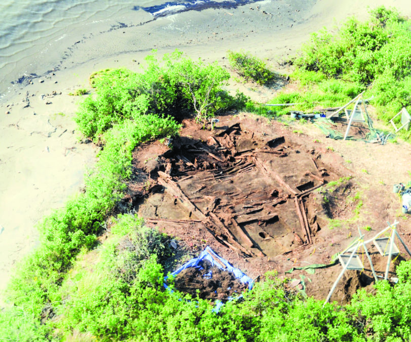
photo courtesy of Michael O’Rourke
Even vegetation growth on the newly-thawed ground can escalate the damage, as roots run deep and “can do a number on these really well preserved organic materials that are still in the ground,” said O’Rourke.
“The Arctic is really remarkable, even on a global scale, in terms of the level of preservation that we see,” said O’Rourke. “So, when we're losing that permafrost we're losing all those organic remains.”
O’Rourke uses Geographic Information Systems (GIS) to map out what he calls the “risk and value” of sites in the NWT.
Key to this is working in collaboration with the Inuvialuit Regional Corporation (IRC) and community elders to identify not only sites of value but what government should try to preserve, with its limited resources, and what can be let go.
“I think, really, the more important aspect of the work that I'm doing is working with Inuvialuit around identifying culturally significant locations and that can include just beautiful spots that people really don't want to see disappear and are in need of management,” said O’Rourke.
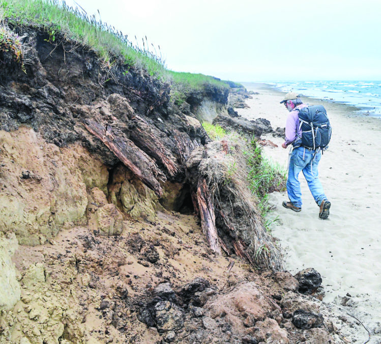
photo courtesy of Michael O’Rourke
The NWT did not hear back from IRC representatives by press time.
Inuvialuit Place Names Project
O’Rourke is also involved with the Inuvialuit Place Names Projects, compiling and mapping thousands of traditional place names in the region.
“I think maps are incredibly powerful tools for consultation and collaboration,” said O’Rourke. “They can really distill some fairly high-level, complex concepts around human landscapes and relationships into this nice visualized package that the human brain can pick up pretty quickly.”
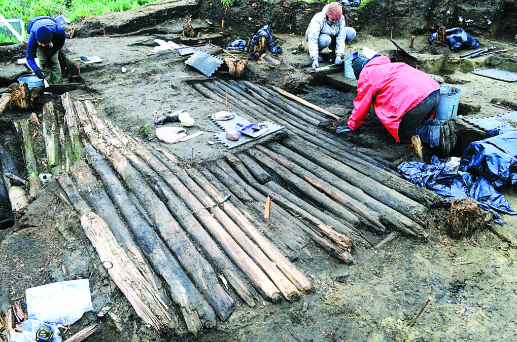
photo courtesy of Michael O’Rourke
While he’s currently stationed in Yellowknife at the Prince of Wales Northern Heritage Centre, O’Rourke says the IRC’s new Igutchaq UAV Inc. venture is opening up exciting possibilities for researchers studying the region from afar. It is also creating opportunities for local work.
The company is set to provide services including drone mission planning and execution; data gathering, management and analysis; as well as test flying new drone systems and equipment.