With several days left in July, there's a chance that Yellowknife may be on track to break the monthly and summer records for precipitation, according to the federal Department of Environment and Climate Change Canada.
"If people think it has been wet, they're right, it has been wet," meteorologist Terri Lang said this week.
The department considers a meteorological summer as being the months of June, July and August. The historical average for Yellowknife summer precipitation is 124 mm.
In the summer of 2018, Yellowknife broke the historical record of 78 years of record keeping with 248 mm of rain.
Last summer brought 135 mm of rain.
As of Tuesday, July experienced 77.8 mm of rainfall compared to the historical average of 40.8 mm for the month.
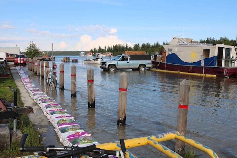
Simon Whitehouse/NNSL photo
"So it has been quite wet for July and over the next couple of days there will be a couple of weather systems that will bring more precipitation – low pressure systems spinning through," Lang said. "So that number will be higher."
Summer 2020 started out reasonably dry enough, she said. May was the sixth driest on record with 3 mm of precipitation versus the historical average of 18.4 mm.
"June came along and there was 28.6 mm of rain received compared to the 28.9 (mm) average historical record," she said.
Average precipitation for a total year in Yellowknife is 288.6 mm, and roughly 40 per cent of that is made up from rainstorm precipitation. Having plenty of rain during the summer makes a difference in terms of combating the chance for wildfires, Lang said.
"Everybody thinks with lots of snow, that is where most of the precipitation comes from, but not necessarily," she said. "With the exception of (the) Arctic, most precipitation comes in summer months. If you melt summer down it adds up to little rain."
Cool temperatures
The amount of summer rainfall has also coincided with cooler temperatures, Lang said.
May saw average temperatures of 3 C compared to the historical average of 4.6 C. The average temperature for all of June was 12.8 C, which is lower than the historical average of 13.3 C.

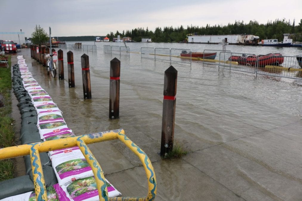
Simon Whitehouse/NNSL photo
July has also, to date, fallen below the historical average. As of Tuesday, it has been 15.9 C compared to the average on record of 17 C for July.
"It has been a little on the cool side, which lines up well with the higher precipitation," Lang said. "With clouds when it is rainy, it doesn't get warm, so generally you find that cooler and wetter go together.
Consistent with Western Canada
Lang said that compared to Eastern Canada and the Eastern Arctic, much of Western Canada has seen wet and cool temperatures to date. She said it has meant that areas in central Alberta have been very wet, as have areas in British Columbia.
"Farmers have been struggling and it has been a quiet wildfire season in British Columbia, for example," she said. "It has also meant late snow melt in northern Saskatchewan and central parts northward into NWT and Yukon. "
Cole Marshall, the Yellowknife Golf Club pro, said that although it has been a wetter summer, it hasn't hurt play so far this season.
"We have had some glimpses of rain and higher-than-normal rains, but it is what it is," he said. "It is the topping of the sundae for 2020. It hasn't impacted us too much beyond maybe a few rained out days... but it has been keeping the forest fires at bay."