October may have felt a bit warmer to most Yellowknife residents, but that was only due to the contrast with a much colder than normal September, according to Environment Canada.

“It probably felt mild after September,” said Brian Proctor, meteorologist with the federal department of Environment and Climate Change Canada.“It was a warmer October compared to September but it was still a fairly cool month overall.”
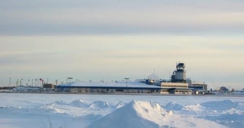
Proctor said according to data from the NAV Canada site at the Yellowknife Airport, the mean temperature for October was minus 2.3 C, which was a bit higher than the monthly average of 1.7 C.
The significant drop in mean average temperature came in September, he said where the figure was 2.3 C. In Sept. 2017, the month had a mean temperature of 10.3 C.
“September was the coldest that we have had for the 77 year period record, based on stats from the Yellowknife Airport,” Proctor said.
Despite the cold weather, the month was especially dry with a monthly average of 8.8 mm, compared to the 32.3 mm average over 77 years.
In October, the average mean temperature was colder than last year as the number dropped to minus 2.3 C. In 2017, the number was minus 1.1 C.
“The last year we had a temperature in October that was approaching the values we saw this year was in 2016 when it was minus 2 C,” Proctor said. “We have to go back to 2004 when it was minus 4 C to get a colder one.”
The results from September and October follow a summer that saw record rainfalls and cooler than average temperatures.
November to January forecast
Proctor says he is not estimating much deviation from the average levels of precipitation or temperature for the November to January period, based on long-term seasonal forecast reports issued by the department at the end of October.
On average between those three months, there is an historical mean average temperature of minus 24.6 C and a precipitation average of 46.4 mm water equivalent – meaning snow and/or rainfall. Both of those figures are based on 76 years of data for Yellowknife.
The last time the city saw a significantly heavier level of precipitation was in 2008 which had 84.4 mm, resulting in a winter with a large snowfall, Proctor added. That same winter, temperatures were among the coldest, too he said, with figures averaging minus 25.6 C.
“We are looking for probably not much difference from normal in precipitation in most of the NWT,” he said. “There are areas with a bit more in Fort Liard and maybe toward Hay River, but everybody else looks normal.”
Proctor said there is a 40 to 50 per cent chance of warmer conditions in the western portion of NWT. This is expected to be the result of a mild El Nino winter where much of the Pacific Northwest is forecast to see higher temperatures than usual. The Yellowknife area, however, is not expected to see much change, he said. .
“Hopefully it will be a bit milder,” Proctor said. “That tends to bring more precipitation, including more snowfall for the western communities where we had forest fire problems this year.”