Paul Bickford/NNSL photo
The Town of Hay River will soon begin planning a multiparty meeting on how to improve berms and overall flood mitigation in Hay River.
Glenn Smith, the senior administrative officer for the town, said the meeting will be organized for a date to be determined.
The idea for such a meeting arose last month following a summer of high water in the Hay River and on Great Slave Lake, which caused some erosion and damage to berms.
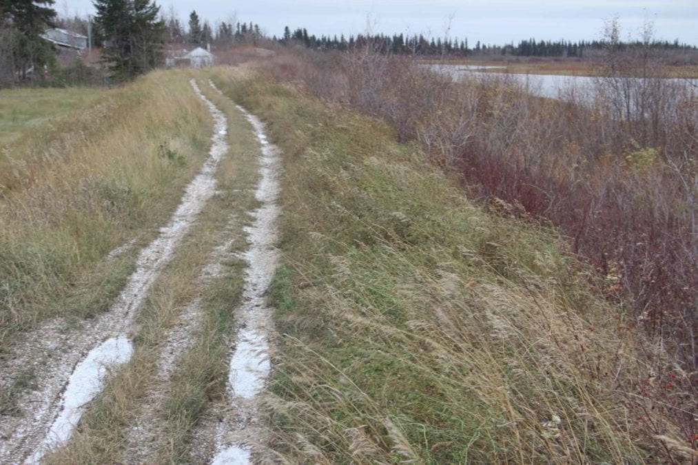
There are two berm systems in Hay River – one protecting West Channel and a shorter one protecting about 13 properties in the Lakeshore Drive area.
"We recognize in particular that, at the West Channel berm, some erosion is occurring and some settling, and there are some opportunities to expand it, as well," said Smith. "But most of that still needs a proper review by professionals in that area."
The berm in West Channel is about 1.5 km long and about two metres high, while the berm in the Lakeshore Drive area is about one-third of a kilometre long and less than a metre high.
The West Channel residential area didn't experience shoreline flooding this past summer.
"But in other areas, such as Lakeshore Drive on Vale Island, there was some fairly localized flooding that occurred there," said Smith.
Part of the berm protecting Lakeshore Drive was breached during high wind over Great Slave Lake on Aug. 29.
In a survey conducted by the town, only one property owner in the Lakeshore Drive area indicated some flood damage.
Speaking during the Oct. 5 online meeting of town council, Smith noted the upcoming meeting with stakeholders will include government agencies, such as the Department of Environment and Natural Resources, the Department of Municipal and Community Affairs, and the Mackenzie Valley Land and Water Board.