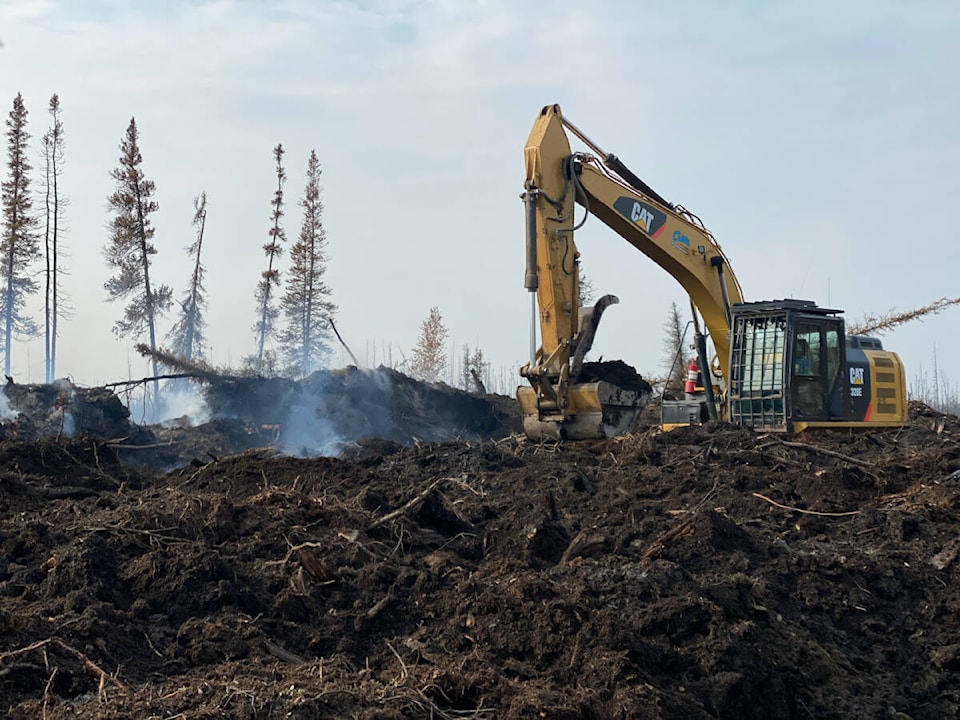
Work on securing the Town of Hay River, K’átł’odeeche First Nation and the surrounding areas continues, with 30 kilometres of fire line in development.
NWT wildfire information officer Mike Westwick gave an update at 3 p.m. today.
“Warm temperatures today with relative humidity (the level of moisture in the air) dropping to around 35-40% as relief from rain continues to dry up.,” said Westwick in the update. ” Temperature to reach about 18 degrees, though some helpful cloud cover should keep fire activity lower and give a good opportunity for the team of crews and heavy equipment to continue getting good work done. Winds from the southeast expected through the burning day, which could cause growth of the section of fire to the east of the Hay River, but unlikely to push much growth near the Town itself.
“Tomorrow, warming continues with temperatures expected to reach 19 degrees. Brisk winds from the south at 15km/h gusting up to 20-25km/h. Rainfall relief is fading in the area. There is still a high level of risk to Hay River and the surrounding area – where fire has reached many populated areas, is within a half kilometre of the hospital and industrial area across from downtown, and very close to the main road in and out of town.
“The Hay River area is in heavy drought – the drought code in the area currently sits at around 700. For context, anything above 400 is extreme. What this means is that there is fire burning deep in the ground through the duff layer – which is the layer of the forest just above the soil full of decomposing leaves and other forest fuel. This fire can flare up and cause further growth and potential damage if the right steps are not taken to secure the area.”
Hay River Kakisa Wildfire SS052 is now 470,511 hectares in size. A team of over 220 personnel, nine helicopters, 26 pieces of heavy equipment, and airtankers are working to contain the fire, which remains out of control. The fire sits one kilometre west of Hay River airport and half a kilometre west of the industrial area and the hospital, as well as half a kilometre from West Point First Nation. It is one-and-a-half kilometres away from Riverwoods Estates and seven kilometres North of KFN. It is 12 km southeast of Kakisa and has come within 10 metres of Highway 2 in some areas. The fire has reached Delancey Estates, Paradise Garden and Patterson Road.
Westwick said firefighters were moving forward with a plan to secure Hay River.
“Heavy machinery and crews covered roughly 15 km of ground yesterday with first passes of approximately 30 km of fire line on the west side of the river,” he said. “More than 15km of line has been covered thus far, from mile 10 on east side of the river and around the finger to the highway with heavy machinery are expected to complete the first pass today.”
Hay River, K’átł’odeeche First Nation and Kakisa remain under Evacuation Order.