When one says the word permafrost, the first concept that comes to mind is a layer of ice below us, but that’s not always the case.
As explained at the first summer edition of the Aurora Research Institute’s speaker series, permafrost actually can mean a lot of different things.
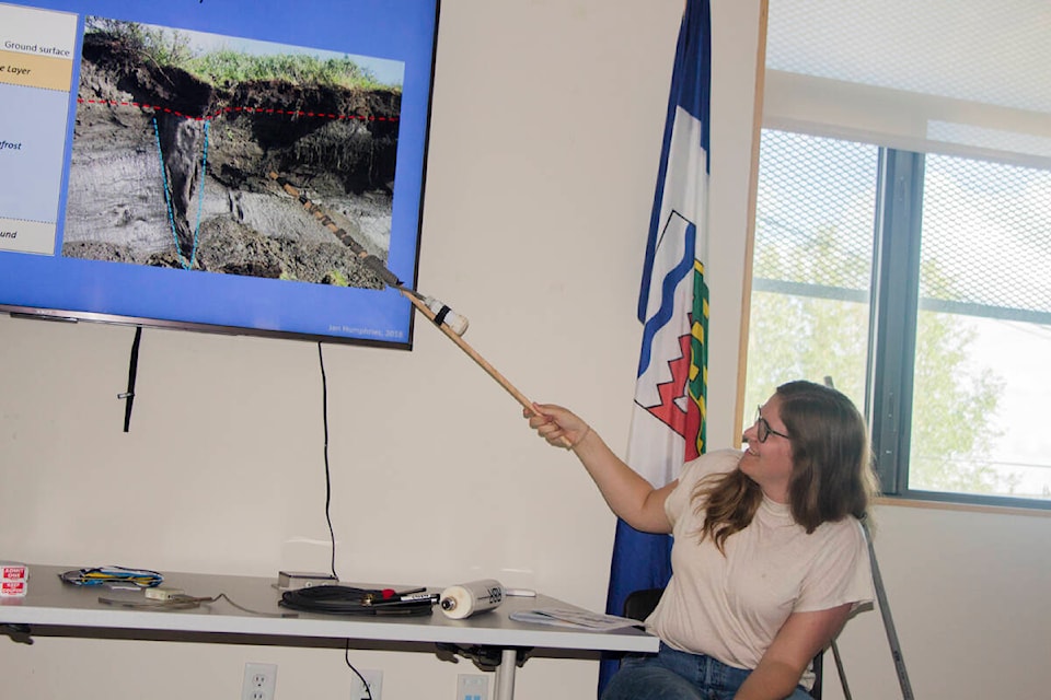
Permafrost experts Jen Humphries of the ARI and Alice Wilson of the NWT Geological Survey explained the different personalities of permafrost June 28.
“Even in the Beaufort Delta, there are so many types of permafrost,” said Humphries. “It is a very diverse landscape.
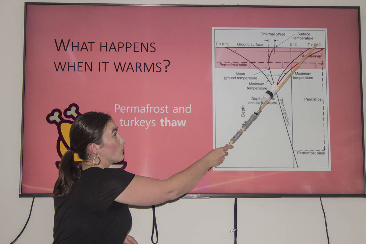
“Permafrost is a thermal division of the ground. It’s defined as ground that stays below 0° C for two or more years.”
Many types of permafrost
As it turns out, not all permafrost has ice. Some types of permafrost are simply rock or soil. Even permafrost with ice can vary dramatically in its structure and distribution.
The most famous permafrost feature are pingos, which form when a lake is suddenly drained of all its water. The exposed bottom of the lake gets colder over the winter, causing a permafrost layer to grow. Then, any water that falls on the growing pingo seeps through cracks in the soil, settling underneath the ice and freezing, pushing the ground above it further up. Essentially, they are a chunk of ice sitting on top of liquid water, covered in soil. Pingos can eventually grow so large they split open, exposing the ice within. The pingo then begins to deflate as the ice melts.
Another sign of permafrost are “drunken forests” — areas where trees appear to grow in a variety of strange directions instead of just straight up. These take their trait from ice beneath pushing the trees off their alignment.
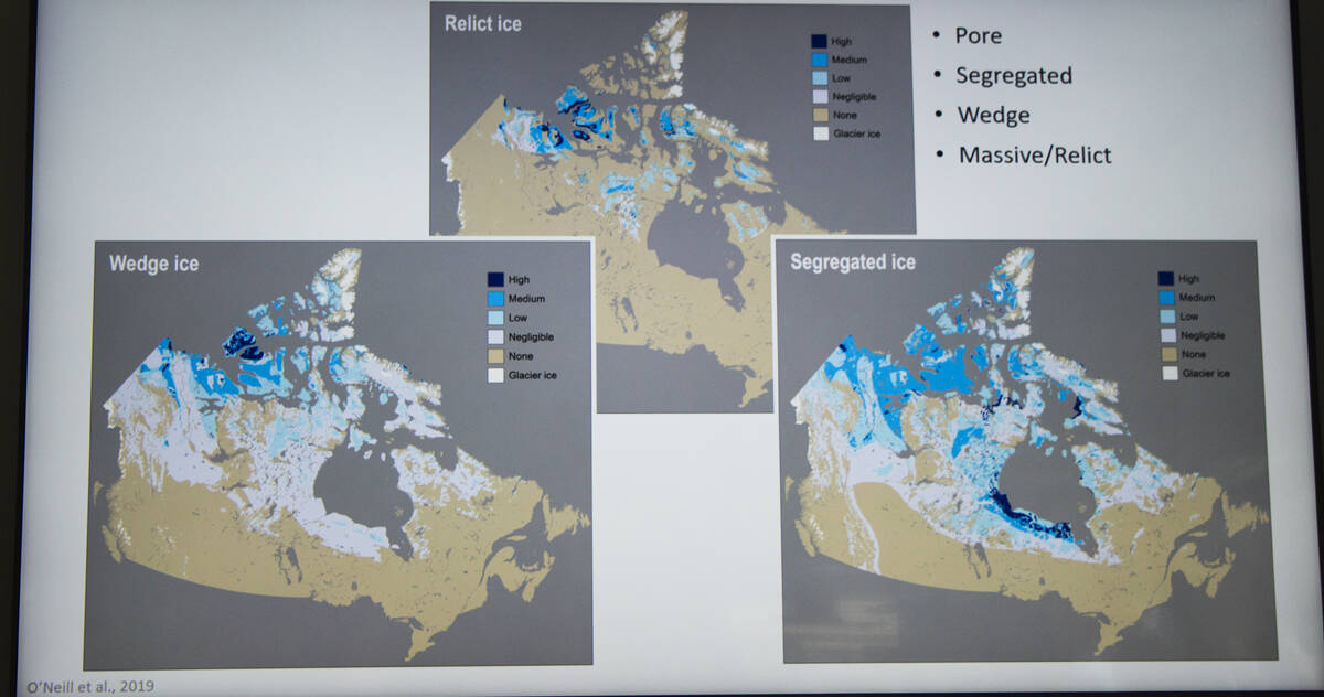
In some cases, “pore” ice can form in between individual soil particles. Another style of icy permafrost is “segregated” or “lens” ice, which builds up over time, depending on the mix of soil and rock as well as the amount of surrounding moisture.
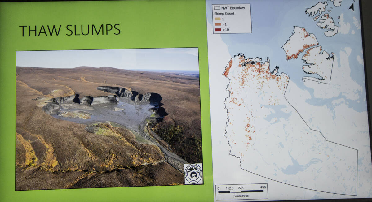
Neither of these three types of permafrost cause major changes to the landscape when they melt. It’s only when there is large amounts of ice, or “massive” ice, when permafrost thaw is responsible for the major slumps and ice wedges seen throughout the Beaufort Delta. On Banks Island, entire landscapes are crumbling away as permafrost degrades.
Massive ice can be further divided into “wedge” ice and “relict” ice, which is ice left over from the last ice age. Wedge ice creates an opening for organic material to accumulate in an opening, further pushing other material away. The results of this can be dramatic. “Thaw slumps,” as they are called, can be seen along the Dempster Highway. These develop when something exposes buried permafrost ice, which begins to melt, exposing more ice.
Other problems involving the freeze thaw cycle that are not permafrost related are icings, where water freezes along with the active later and pushes the surrounding ground upwards and frost blisters, where ice is forced to the surface and melts, leading to more erosion of the soil and more exposed ice.
Ice Age Legacy
Permafrost thickness is entirely dependent on how much glacial ice was covering the ground over the last ice age. Areas that were exposed to the freezing Arctic temperatures had a lot more time to develop permafrost compared to areas insulated by ice or water. Around 10,000 years ago the glaciers began to receded and Tuktoyaktuk was one of the first areas to be uncovered by ice and has permafrost as thick as 500 metres in some areas. For comparison, Inuvik was covered by glacial ice for much of the last ice age and only has 90 m of permafrost. As ocean levels were considerably lower during the ice age, the continental shelf extended 100 m out far further as well. Consequentially, there’s even permafrost below bottom of Kugmallit Bay — up to 750 m deep.
As glaciers receded they left much of their ice buried below the soil. Consequentially, much of relict ice around Ulukhatkok is a leftover of the last glaciation.
Another thing people might not know about permafrost is that it’s not continuous. As water has a high specific heat capacity, rivers can carry a significant amount of heat. Enough to prevent thick permafrost from developing below them.
Protecting permafrost from outside heat is the active layer, which is the layer of Earth directly above the permafrost that freezes and thaws each year with the seasons. Thickness of the active layer decreases as you move further North and temperatures get colder. Between Inuvik and Tuktoyaktuk, the active layer ranges from 30 to 80 centimetres. Going further North to the high Arctic it’s only 15 cm thick.
An important note about permafrost is that it thaws. It does not melt.
Slowly thawing
Exactly how the permafrost is responding to climate change depends entirely on where it is.
In Inuvik, ground temperatures have been warming roughly 0.2° C to 0.6° C per decade. Similarly, the active later has increased by a 1-3 cm per decade. Both Wilson and Humphries noted the rate of permafrost decline is currently minimal within town.
Regardless, buildings can take precautions to keep the ground beneath them cool and ensure long-term structural stability. A problem with the Igloo Church sinking was resolved by venting cold air into the basement. Thermosyphons, such as those used at the Inuvik Health Centre, can also be used to keep the underlying ground cool.
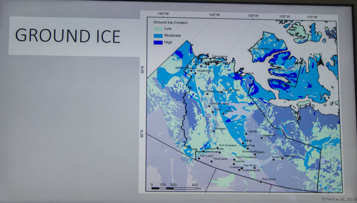
Fortunately for developers, the GNWT has the entire permafrost of Canada’s North mapped out, so infrastructure planners can work around nature as climate change progresses.
“Permafrost has personality,” said Wilson. “Depending on the soil type, how much moisture there is in the soil above, you can get all these ice-types forming in permafrost. The one that causes the most problems for people tends to be massive ice.”