Much has been written about the precarious state of permafrost in the Arctic, but a new interactive scientific paper maps out the extent of permafrost — both on the land and under the water.
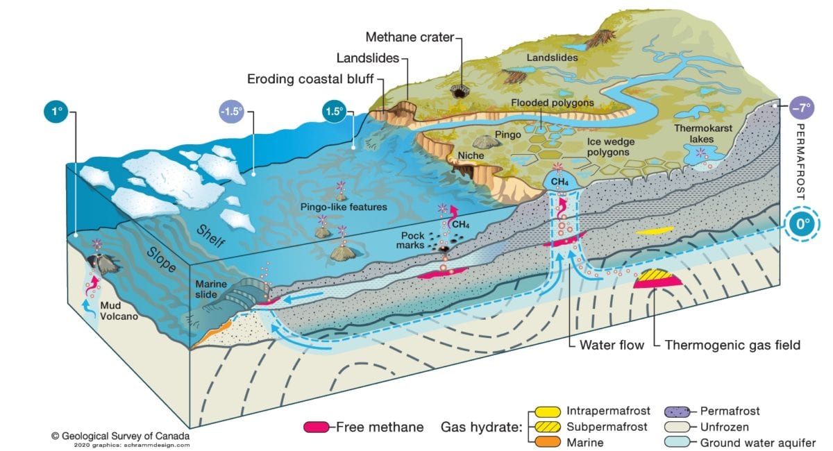
Photo Courtesy GRID-Arendal, 2020
Evolving out of the expertise at the Aurora Research Institute and Inuvialuit Innovation, Science and Climate Change, and funded by the United Nations Environmental Programme, the Coastal and Offshore Permafrost Rapid Response Study mapped out differences between parts of the Arctic, identifies knowledge gaps in current understanding of permafrost systems and makes numerous recommendations to help fill them.
"It's a community of people who have come together to do this assessment," said Scott Dallimore of the Geological Survey of Canada. "It was meant to be a circumarctic-type assessment. We considered the entire Beaufort coast, Alaska, Yukon, NWT and all aspects of Siberia. A lot of the lead researchers that were involved were Canadian and had worked in Inuvik, and all of us were basically out of the Aurora Research Institute.
"You'll find a lot of the videos on the website are also Inuvialuit videos. We're using material that already existed and putting it front and centre on the website."
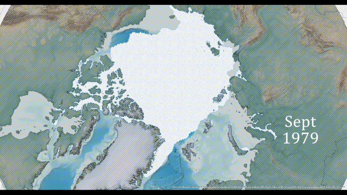
Dallimore explained that the western Arctic that includes the Beaufort Delta is unique in the fact there was little to no glaciation in the area during the last ice age, allowing average temperatures of -30C or lower to freeze the ground into permafrost. As the glaciers receded back into the mountains, ocean levels rose, covering much of the permafrost underwater where it remains today.
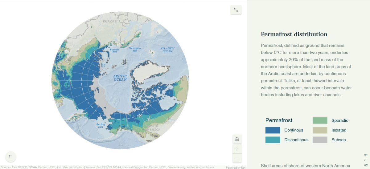
However, much like the permafrost on the land the submerged permafrost is being thawed out by warmer temperatures, though because most of the focus has been on surface permafrost scientists are still working out the extent and rate of deterioration.
"Most people who live in the communities in the North don't realize the thickest permafrost accumulations in Canada are actually in the offshore," said Dallimore, who noted permafrost can be found as deep as 750 metres underground. "You see all these stories about coastal erosion — but really it's the study and examination of how the coast and the offshore are responding together.
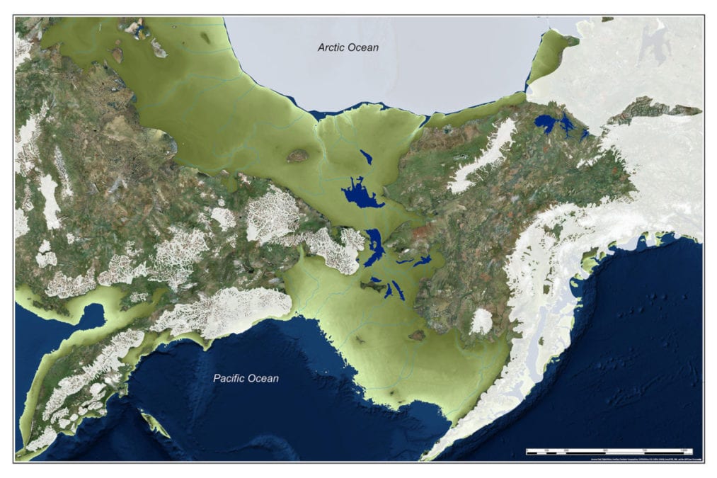
"It's not just the erosion of Tuktoyaktuk, it's the landscape behind Tuk, and the Inuvik-Tuktoyaktuk-Highway and the vegetation response and the lakes and what they're doing, and also the near-shore environment where you had sea level rising and the coast has migrated 120 kilometres inland from where it used to be. There's this fascinating environment which is really understudied and that's what we're trying to draw attention to."
Also part of the interactive paper is a crowdsource map that readers can add their own observations of climate change and how it is affecting the landscape. Dallimore said having the map would help people direct the researchers where to look.
Most of the recommendations revolve around where to take research next, but also to expand the regional capacity for science and engineering by establishing more coastal science projects and increasing investment for education of youth in the Delta to help Gwich'in and Inuvialuit become more involved in scientific research.
Read the entire report here. The crowdsource map can be accessed here.