Jeff Grieve is in the early stages of making an interactive, digital map that would allow Inuvialuit people to access information and multimedia through the Internet about their cultural heritage.
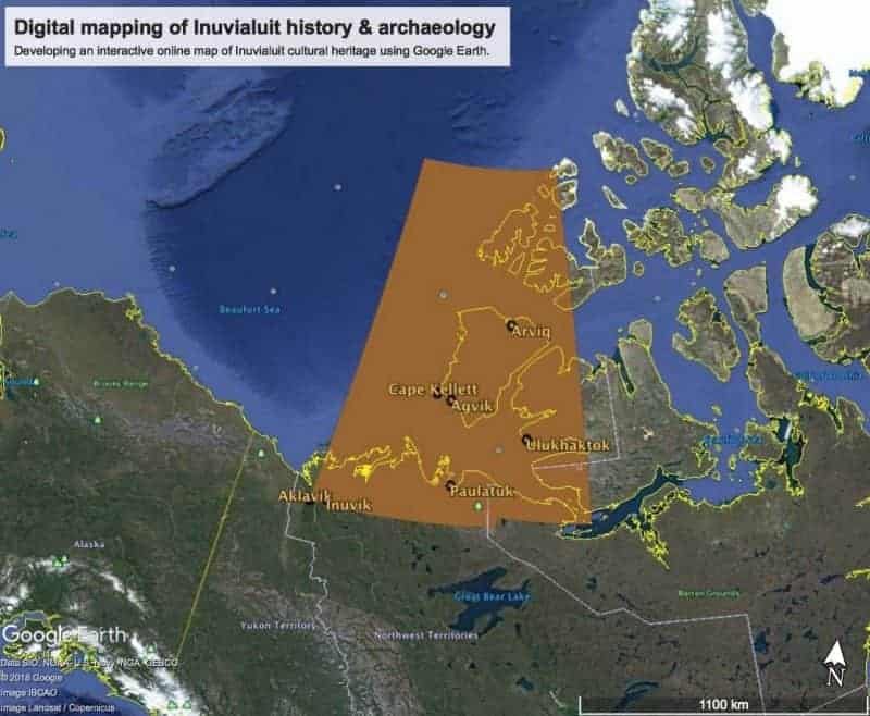
Photo courtesy of Jeff Grieve
Grieve, an archeology master's student at the University of Western Ontario, is working in partnership with the Inuvialuit Living History Project to determine how and if this map should be created.
He said the map would contain information about physical artifacts such as ulus, harpoons and arrows, and even locations such as trap lines.
Grieve has a background in information technology and archeology and said he hopes to be involved with building the map's technological framework, but will leave the creation of the map's content and history up to community members.
"This map would ideally be something the community would take forward and construct," said Grieve.
He said he was in Inuvik in July to begin consulting with community members about the project, and so far, he's hearing positive feedback.
"It's very early days but we are very encouraged, I think there is a positive receptiveness to the idea of a map being a good way to communicate the information and history," said Grieve. "I've heard consistently that an elder, in a traditional language, should be telling the story of how that object would have been used in order to preserve culture and history in the original language."
He said he is exploring options for content that the map could contain, such as pictures, videos and audio.
"For example, an ulu, which is a traditional … knife used by Inuvialuit for cutting, meat prep, and food prep … that's an example of an artifact that could be found on an archeological site," he said. "A picture, or even a video showing how such a knife would be used and where it was found is what this map would potentially show."
He said there is potential for the information to be presented in Inuvialuktun, and accessible on mobile phones through an app.
Grieve said he will be back in Inuvik in late September and early October 2018 to consult with more community members about their ideas and concerns about the map.
"I want to talk to people about what's the right way to do this is. Are there sensitivities that shouldn't be included, like grave sites, which should be treated with respect? What's the right way to handle those?" said Grieve. "It's a very exciting project and I think there is some interesting potential. It just requires more discussion and dialogue with communities."
Grieve highlighted that the purpose of the map is not wayfinding, but to evoke memories and pass on knowledge.
"The Inuvialuit know the land like the back of their hand. They don't need a map," he said. "But this kind of a map might be a way to evoke memories, and memories in turn stimulate stories to be told."