Mining prospectors, urban planners, entrepreneurs and scientists all have a new tool at their fingertips for assessing land for potential ventures, thanks to the efforts at the Aurora Research Institute in Inuvik.
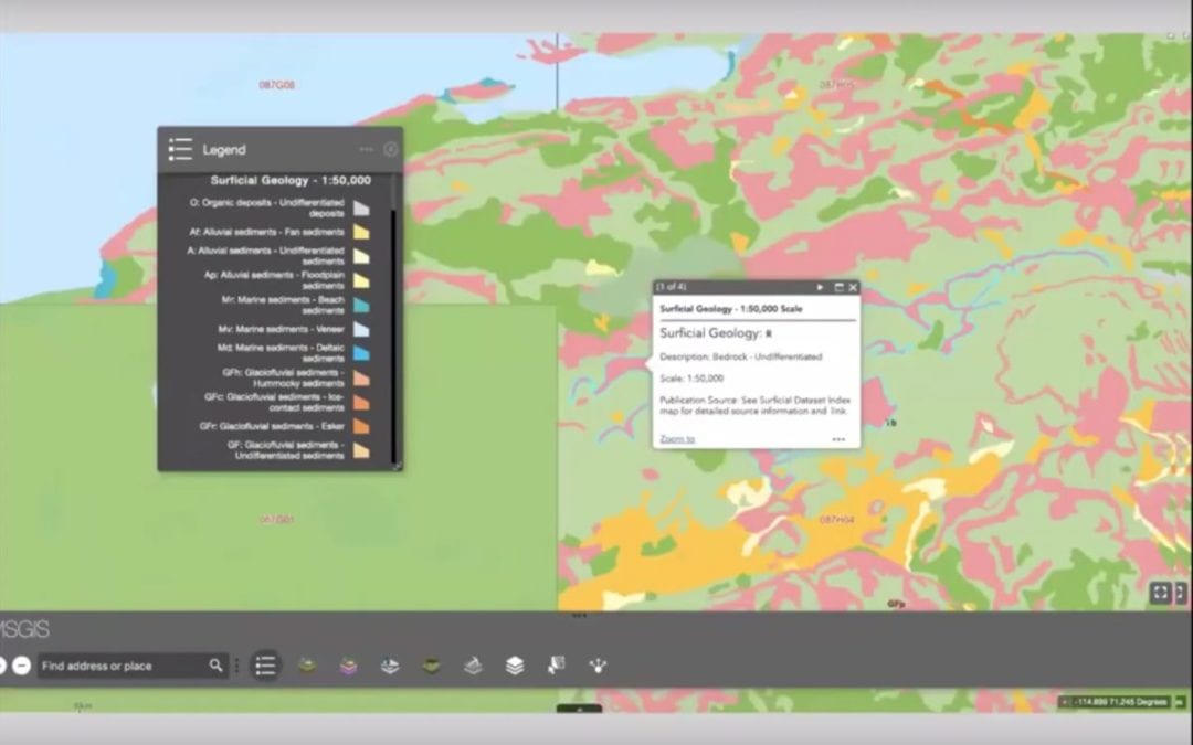
Photo courtesy Aurora Research Institute.
A product two years in the making, the Western Arctic Mineral Strategies Geographical Information System (MSGIS) allows anyone to select an area and access vital information about wildlife assessments, mineral exploration, zoning rules and other helpful information for determining where to start a new project in the Beaufort Delta.
"The MSGIS is meant to bring together meaningful and current data from a variety of fields in order to support well planned, eco-and-community friendly investments in mineral exploration," said GIS technician Celtie Ferguson, who began working on the project as part of her internship and carried it onward as she was taken on full-time. "By selecting a location of interest, the MSGIS will illustrate what is where and help further understanding of cumulative impacts on the land."
With the software, available for use at https://msgis-nwt.maps.arcgis.com/home/index.html, anyone who sets up an account can look up historical data for properties across the north, including land use planning documents, mineral strategies, wildlife conservation areas, species at risk designations, land authority, municipal boundaries — even fault lines. Most of the data is drawn from the Geo-mapping for Energy and Materials (GEM) program, which has been updating maps in the north since 2008, and is cross-referenced with sociological and environmental datasets.
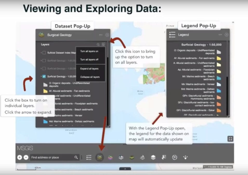
Photo courtesy Aurora Research Institute.
More can be added by the end user to suit their own needs as well. Data can also be kept confidential on the server if required. However, Ferguson noted the system only compiled data from existing sources, so anyone using the data for their work is encouraged to follow links to their original sources in case newer data is available.
With the project done and launched, project manager Garfield Giff said the ARI would maintain the system for the next six to seven months, though the long-term goal was to outsource the software to local governments like the Inuvialuit Regional Corporation and the Gwich'in Tribal Council to keep it going.
"We can also create a version for organizations where they can add additional data that we don't have but is important to their organization," he said. "So if an organization needs it, just reach out to us and we can provide them with it and they can have the tool in-house, not shared to the public, add their own data to it and use the tool.
"The tool is created for all to use. Just ask for it and we'll provide it to you."
An instructional video has also been published explaining how to use the tool. Check it out by clicking here.